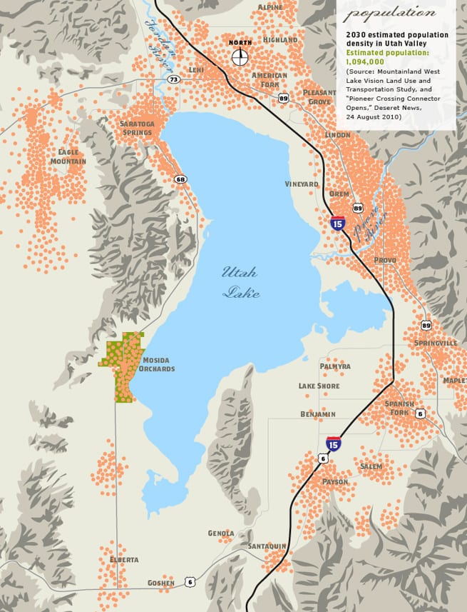
Look around Utah Valley. Road construction and expansion tries to keep pace with population growth. More waiting in lines and every day congestion pile ups. Development creeps into the foothills and other places never before considered a good area for development. A giant “elephant in the room” that no one considers an asset—Utah Lake is ignored. Landlocked communities with no areas for residential or commercial growth are looking for options. Alternatives are needed for workers in Salt Lake and Utah valleys who commute from one area to the other.
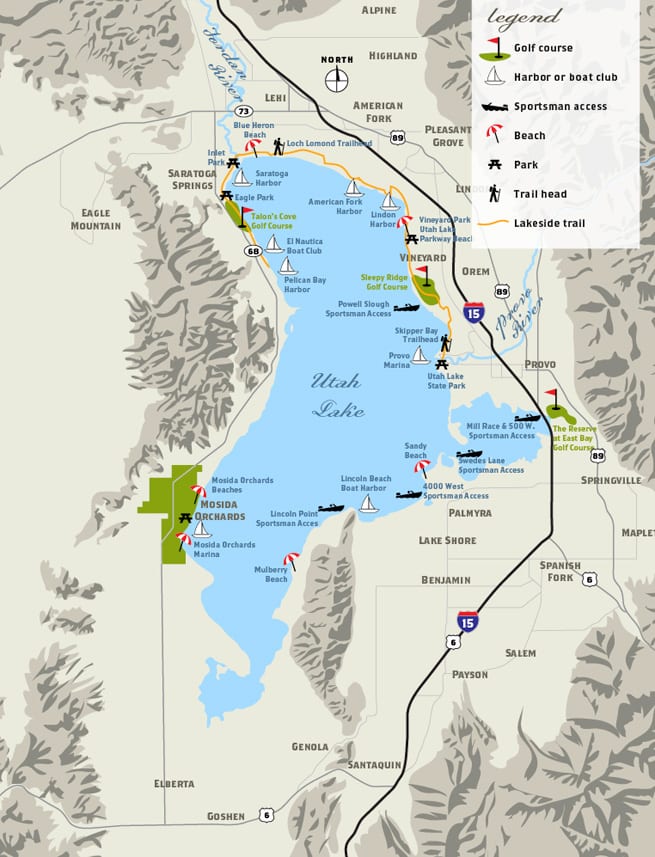
Mosida Orchards opens up Utah Valley with options for travel, residential and commercial development, open spaces, a new vantage point of Utah Lake, and access to and from both Salt Lake and Utah valleys.
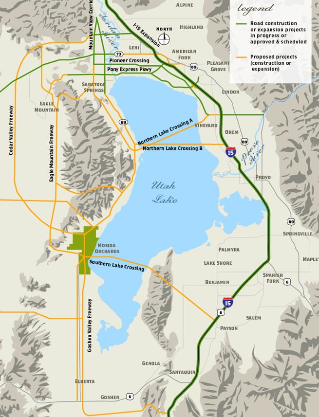
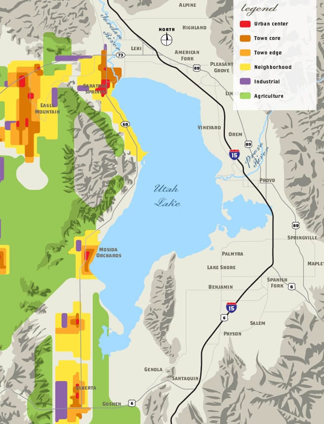
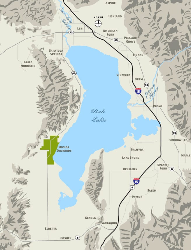
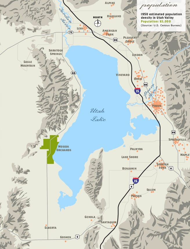
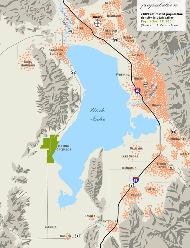
Our maps, shown below, demonstrate the dramatic changes we can expect in our community. Property owned on the west side of Utah Lake will provide a great investment opportunity.

The West Lake Vision Study by Mountainland Association of Governments prepared a complex study of how to manage the continued rapid growth in Utah, most of which will occur within the Wasatch Front region. Mosida Orchards is one of the prime components of that plan being located on highway 68 on the east side of Lake Mountain looking east across Utah Lake at the Utah Valley. (see Introduction & Final West Lake Vision on page 27)
The TransPlan40 regional transportation plan, just recently approved, recognizes that growth west of the I-15 freeway. “Since the year 2000, the West Area (including Lehi, Eagle Mountain, and Saratoga Springs) has been the epicenter of statewide growth adding more than 80k people. Lehi is seeing explosive growth in the high-tech sector earning the title ‘Silicon Slopes’ since 2000 has increased 352%. Mosida Orchards is located just 7 miles south along the west bank of Utah Lake.” (This information is located on page 4 of this study.)
1950 population map
2009 population map
2030 population map